Description
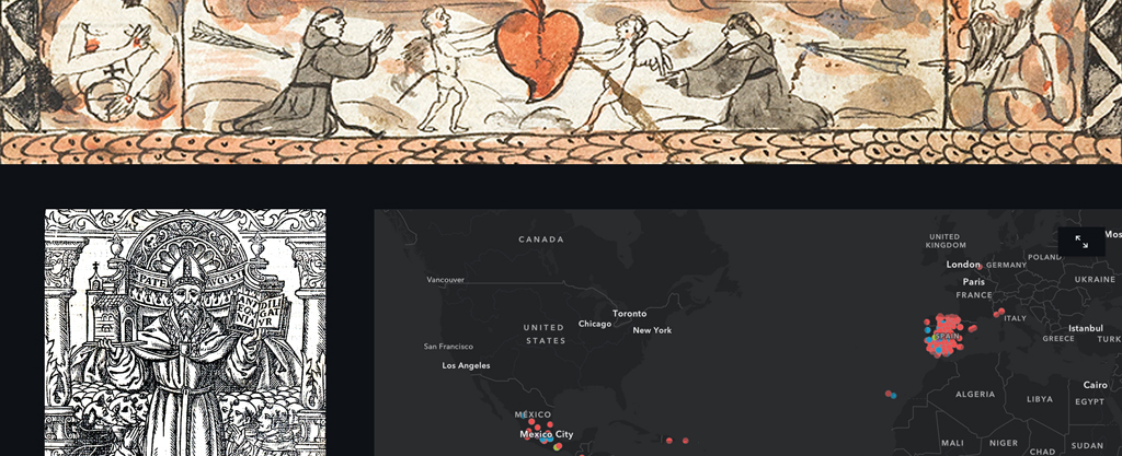
This step-by-step tutorial will introduce you to ArcGIS Online and ArcGIS StoryMaps, free web-based tools that help you visualize and present geospatial research, using data and images from materials related to the Augustinian Order in sixteenth-century Mexico preserved at the Benson Latin American Collection.
Date Range(s): 1533-1600
Grade Level(s): Undergraduate; Graduate & Professional
Country(ies): Mexico; Puerto Rico; Dominican Republic; Mexico; Guatemala; Colombia
Course Subject(s): Art & Art History; Digital Scholarship; Indigenous Studies; Latin American Studies; Linguistic & Language Studies; Literary Studies; Religious Studies; World Geography Studies; World History Studies
Topic(s): Augustinian Order; Catholic Church; Maps; Book History; New Spain; Bishops; Missionaries
Learning Objectives
- Know the basics for developing a geospatial dataset (spreadsheet)
- Learn how to create a map in ArcGIS Online using a geospatial dataset
- Explore the available design features in ArcGIS StoryMaps
Downloads
Reference Materials: Tutorial | Final Project Example
Tutorial Downloads: Sample Text & Images (automatic ZIP download) | Geospatial Dataset (only download “Augustinian_Professions_16thCent_Mexico.xls” file)
Rights Statement
Creator(s): Albert A. Palacios, Digital Scholarship Coordinator, LLILAS Benson Latin American Studies and Collections
Date: 2020-02-27
This tutorial is under a Creative Commons Attribution-NonCommercial-ShareAlike 4.0 International Public License (“Public License”). This license lets others share, remix, tweak, and build upon the work non-commercially, as long as they credit the creators and license their new creations under the identical terms.