Original manuscripts and maps created in response to the first survey of New Spain mandated by King Philip II. They include historical, cultural, and geographical information about the region in the 16th century.
The Royal Archive of Cholula contains the documentation of the old Corregimiento of Cholula, one of the nine “Cities of Indians” that existed in New Spain. This colonial institution functioned as a district seat and had the powers of government, law, finance, and war over Indigenous villages and the Spanish, Black, Mestizo, and Creole populations.
Students will learn about how Indigenous and Spanish women navigated Spanish colonization and patriarchy in Latin America. This unit explores women’s agency through the figures of Malintzin (Malinche), Sor Juana Ines de la Cruz, and Catalina de Erauso.
In this lesson, students will identify the causes and consequences of the European Expansion. They will consider the importance of Hernan Cortes and Francisco Pizarro in the Spanish conquest of the Americas.
In this lesson, students will analyze images to compare the role of indigenous women in Mesoamerica before and after the Spanish colonization. They will consider how Malintzin, a Nahua woman from Coatzacoalcos, contributed to this process and how women resisted or adapted to the changes introduced by the Spaniards.
Students will learn about the Mapuche, their worldview, lifestyle, and resistance. Through primary sources, they will analyze the day-to-day life of Spanish women in the Araucarian wars, such as Catalina de Erauso, also known as Alonso Diaz. They will find more information to consider how women used the legal and societal conventions to defy gender identity in colonial Latin America.
This step-by-step tutorial will introduce you to ArcGIS Online and ArcGIS StoryMaps, free web-based tools that help you visualize and present geospatial research, using data and images from materials related to the Augustinian Order in sixteenth-century Mexico preserved at the Benson Latin American Collection.
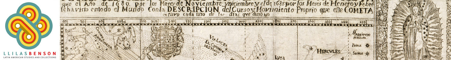
The exhibition focuses on three distinct moments when maps played an integral role in the transformation of Mexico and its political geography. In the sixteenth century, early colonial pictographic maps drawn by indigenous artists reflect the growth of Spanish colonial administration. In the eighteenth century, new maps of Mexico’s principal cities serve as both representations and instruments of the viceregal government’s efforts to re-order and regulate Mexican social life and public spaces. In the nineteenth century, maps are central to the military struggle for independence and the defense of contested national borders.
")
")
")
")
")
")
")
")
")
")